CaGIS/ASPRS 2013 Specialty Conference • www.asprs.org/Conferences/San-Antonio-2013
22
Technical Program
Wednesday October 30th
Special Session
Crowd-sourcing: Formalizing Geospatial
Crowdsourcing in the Crisis Mapping
Community
Moderator: Dapeng Li,
University of Utah
, United States
Formalizing Geospatial Crowdsourcing in the Crisis Mapping
Community
Sophia Liu,
U.S. Geological Survey
, United States
Understanding the Geoweb in Authoritarian Contexts
Cameran Ashraf,
UCLA
, United States
Using Geotagged Tweets to Explore Geographic Disparities of
Twitter Users: a Case Study of New Jersey State, U.S.
Dapeng Li,
University of Utah
, United States
Thomas Cova
11:45 am – 12:45 pm
General Session 3
Leveraging the Geographic Dimension
for Analyzing Humanitarian Emergencies:
Open Source, Imagery, Crowdsourcing,
Mobile, and Semantic Web
Joshua S. Campbell,
Geographer and GIS Architect, U.S.
Department of State
, United States
Geographic data, analysis, and visualization are key tools used by
the U.S. Department of State’s Humanitarian Information Unit
(HIU) in the analysis of humanitarian emergencies. This presen-
tation discusses the HIU’s strategy to build a modern geograph-
ic computing infrastructure and new workflows to support this
analysis. Specific topics include the construction of the CyberGIS
and the Syria Viewer; a new crowdsourced mapping methodol-
ogy called “Imagery to the Crowd” and its results in Uganda and
Nepal; a new mobile data collection and distributed geospatial
data sharing toolkit called GeoGit; and, the use of semantic web
technology for data harvesting and integration. Taken together,
these technologies form an end-to-end solution for collecting,
integrating, analyzing, visualizing, and disseminating geographic
data and analysis. The entire system is built from free and open
source software, making the acquisition cost very low, and it is
interoperable with other software through support of open stan-
dards. In building this system, the HIU is increasing the efficiency
of its analysis, and increasing the availability of geographic data
for humanitarian disaster planning and response by making these
tools accessible to the broader humanitarian community.
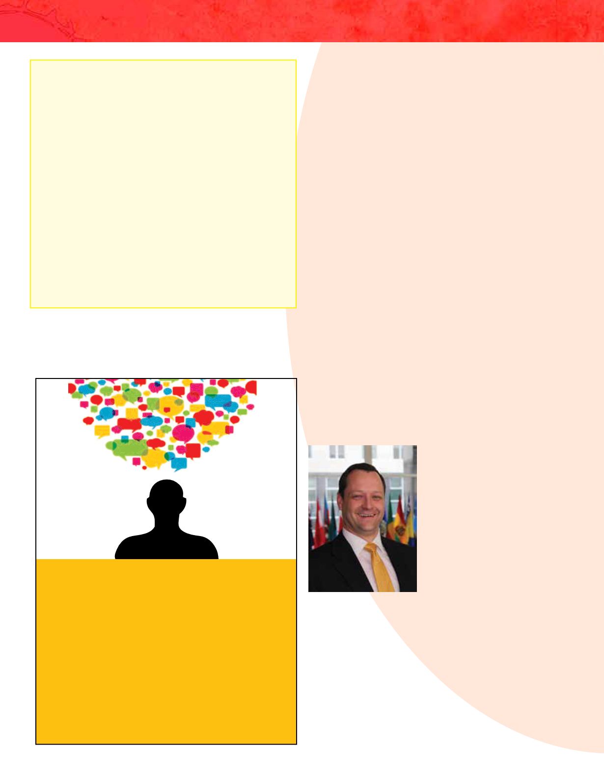
Joshua Campbell is a Geographer
and GIS Architect at the Humanitari-
an Information Unit (HIU), a division
of the Bureau of Intelligence and Re-
search’s Office of the Geographer
and Global Issues, U.S. Department
of State. He is the architect of the
HIU’s geospatial cyberinfrastructure,
referred to as the ‘CyberGIS’, and has
built humanitarian-focused mapping
applications related to the Syrian
refugee crisis, the Horn of Africa
famine, and the U.S. response to the
AIDS epidemic. Technologically, the
CyberGIS is built completely from free and open software, and has
components for automating application production, advanced
data management, web processing functions, spatial data sharing,
and mobile data collection, all designed for use in humanitarian
applications. He also helped pioneer the Imagery to the Crowd
(IttC) initiative, a process that utilizes the CyberGIS to publish
USG-purchased commercial satellite imagery, in the form of on-
line web map services, to the volunteer OpenStreetMap (OSM)
community. Using these image services, volunteers contribute ef-
fort into mapping tasks that directly support the prioritized provi-
sion of humanitarian assistance. Campbell is currently completing
his PhD in Geography from the University of Kansas, where he also
holds a Bachelors in Anthropology and a Master’s in Geography.
2014
ASPRS annual conference
All New
Business Focused Track
Submit Your Presentation Today!


